Xinjiang-Tibet Highway (Road 219): Kashgar to Domar
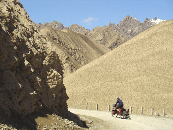 ascend to the first pass on the Xinjiang-Tibet highway |
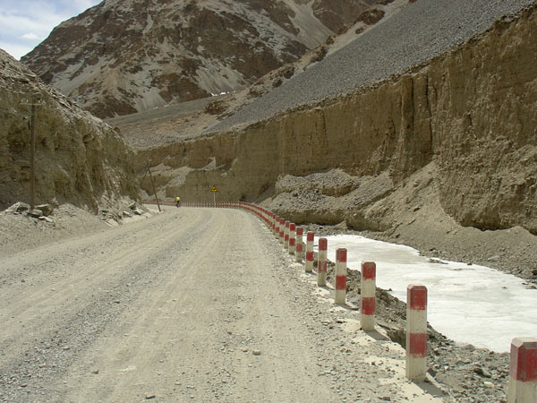 downhill from Chiragsaldi pass . |
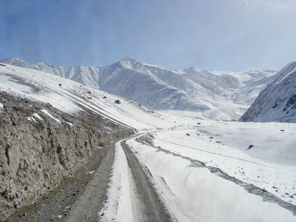 ascend to Khitai pass . |
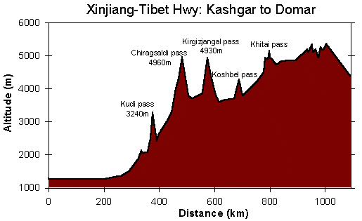
The table below contains basic information about the road between Yecheng
(Kargilik) and Domar. In villages and truckstops listed, basic food (noodles,
rice, sugar, biscuits, etc) is available in small shops and restaurants
and it is possible to eat good food in restaurants or sleep there. The villages
and truckstops are also valuable to get (hot) water. The list does not contain
the road work camps, as they were all abandoned in the time we were traveling
(March/ April), only settlements we have actually seen are listed. There
is quite some truck traffic on this road. Thus, large stretches are very
corrugated, and it is extremely dusty.
Road construction season on this road is between May and October, if traveling
outside this time, all road construction camps along the way will be closed.
In late winter and early spring road conditions are at their worst!
Distance Table and general information |
Something about checkpoints (May 2008):
At least in the years 2003 to 2007 going into Tibet in direction of Ali
did not seem to be a problem.
Along the Xinjiang-Tibet Highway there is a lot of military presence. In
the past they did not care about cyclists as long as one did not interfere
with their business. The military checkpoint at Kudi has one guarded barrier
at the end of town, which are closed. Every person passing through is required
to report their passport at the military police. Possibly it can be passed
at night? Currently (2008) cyclists are being sent back by any of the military
checkpoints along road 219.
Be aware that the situation can change any time
- be careful anyway.
| km marker | altitude (m) | description Yecheng (Xinjiang Province) to Domar (Tibet); Road 219 |
| 0 | 1375 | Yecheng (Kargilik). The turnoff is just after town towards the left (south), paved road for the first 90 km. Right after the turnoff on road 219 there is a gas station and then a large extended army base. |
| 25 | road repair station and small village (no shops!) | |
| 61 | village | |
| 71 | 2130 | village Pusha (with restaurants, shops) |
| 93 | end of paved road, start of dirt road | |
| 97 | small village Akmeqit (small shop) | |
| 113 | 3300 | pass Akmeqit Daban |
| 128 | 2400 | road repair station and small village; very bad road in Tiznap He valley |
| 130 | small army base | |
| 133 | start of pavement - new asfalt road, finished in October 2004! | |
| 161 | large village Kudi; large military base and checkpoint at end of village. Travellers must show their passports. | |
| 194 | 4000 | end of pavement - new asfalt road ends |
| 217 | 4990 | pass Chiragsaldi Daban |
| 241 | 3780 | truckstop Mazar; bad road in Yarkant He valley |
| 292 | 3900 | begin of steep ascent |
| 309 | 4950 | pass Kirgizjangal Daban |
| 352 | 3600 | valley of Karakax He; in the valley again very bad road! |
| 363 | 3700 | large village Xaidulla (large army base) |
| 425 | 4290 | pass Koshbel Daban |
| 488 | 4200 | truckstop Dahongliutan |
| 535 | 5190 | pass Khitai Daban |
| 575 | 4830 | turnoff for large military base Tianshuihai |
| 672 | 5220 | pass |
| 676 | 5120 | truckstop Sirengou |
| 693 | 5450 | pass Satsum La |
| 700 | 4940 | Lungma Co |
| 710 | 5250 | pass Lungma La (with Chang Tang Nature Preserve sign) |
| 730 | 5195 | small village Sumxi |
| 832 | 4435 | village Domar (army checkpoint) |
Other descriptions
of the Xinjiang-Tibet Higway:
Xinjiang-Tibet
Highway (Wolfgang Dressel)
Xinjiang
to Tibet (2011): Description of conditions after 2008 on road 219 (Charlie
Walker)
Highway
Yecheng over Western Tibet to Kathmandu (Andreas Blum), very detailes
with satellite images
Kashgar-Kathmandu
km-table (Uli Sertl)
West
Tibet Kashgar to Kathmandu (Martin Adserballe)
Kashgar-Ali-Kailash-Lhatse
(Janne Corax)
Tibet Overland,
the book contains descriptions of the route Lhasa-Kailash-Ali-Yecheng
Stages of the West to East bike tour across Tibet:
Overview
Kashgar to Deqin - about 5000 km in 11 weeks. The tour leads from barren high plateau in the West to lush green forests in the East. More…
Fotos
Tibetan wild life
Xinjiang Tibet Highway
West Tibet / Chang Tang
Lhasa
Transhimalaya
Friendship
Highway
East Tibet
Kawa Karpo Region
Road Information
Xinjiang
Tibet Hwy (219)
Minor Roads West Tibet
Transhimalaya
Highway
Friendship
Highway
Yunnan Tibet (318/214)