Border Crossing between Torres del Paine and Moreno Glacier
|
Torres del Paine National Park and Moreno Glacier National Park are about 60 km apart, however, the "official" road from one to the other is a 300 km detour. Not only that, the border between Chile and Argentinia is somewhere between these two spectacular points of interest. This makes direct access more political, and so far, there have been no official border crossing points installed for hikers or cyclists who want to directly move between the two National Parks. However, for hikers and cyclists there are some possibilities to sneak through:
recommended maps:
Patagonia Sur & Tierra del Fuego - costa a costa" 1:100000 (ISBN
1-879568-13-6; Zagier & Urruty Publications; 1994). You can pick it
up in the National Park Headquarters.
| Valley of the Rio Zamora |
Variant 1) For
cyclists it involves a lot of pushing and it may be more suitable for hikers.
It leads through spectacular nature. Follow the east side of Rio Paine to
Lago Paine. From Regugio Lago Paine follow the northern shore of Lago Paine
to Rio de los Caiquens. Follow the river about 10 km upstream until the
river beds to the West. Cross a small pass to the Northeast. Follow the
valley for about 18km into the Valley Rio Zamora. Follow the Rio Zamora
due North. After about 10 km the river bends East, continue North over the
Paso Zamora la Rosada to Agentinia. On the Argentinian side, follow
the Rio Rico downstream to the road (about 20 km). You will be able to see
the track leading to Moreno Glacier on the norther shore of Lago Argentino,
you can navigate on sight from here on. There are several possibilities
now.
The border: There is no one at the border, and you may have to climb over
the border fence/gate. On the Chilean side there are no difficulties in
finding the way. The track on Argentinian side is rather minimal and hardly
used.
Variant 2) Also rather tough, but shorter than variant 1. From Laguna Azul follow the Rio Zamora a bit, but then turn into the valley of the Rio del las Chinas towards the East and then to the North - this stretch involves a lot of bike pushing and river crossings. Follow the river upstream for about 30 km, then follow the Eastern fork of the creek over a pass to Argentinia. You will again end up in the valley of the Rio Rico leading to a road from which you can see the Lago Argentino.
| Paso Verlika |
 |
 |
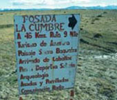
Sign at the turnoff (near the Lago Sarmiento)
to Estancia "La Cumbre". |
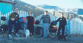
Estancia "La Cumbre",
offering bed & breakfast on the way to the Paso Verlika. |
This variant is probably
most suitable for cyclists. From the entrance to the Torres del Paine National
Park return to the track leading to Puerto Natales and follow it south until
up to the big river Rio de las Chinas (about 25 km). At a turnoff there
is (was?) a sign for Posada La Cumbre (50km) towards the Northeast. The
track is very good and after 10 km you will pass through a village with
a small customs post. Say you are visiting the Estancia La Cumbre or pass
unseen. The track follows the valley of the Rio Baguales upstream, one exception
is the steep ascent across a small hill on the Western side of the river.
The landscape is spectacular. The track ends at the Estancia La Cumbre,
you have to cross the river over a suspension bridge. You can recognize
the Estancia by its yellow guest house with blue roof. The family running
the place is quite friendly and you can stay over night there.
From the Estancia follow the valley upstream towards Northeast, you will
have to do several crossings of smaller creeks. The first 14 km to a small
wooden shed are on an o.k. track, but soon you will be moving on foot paths
or horse trails. From the shed head northeast for approx. 3 km and then
towards North (approx. 3km) to the Paso Verlika. Paso Verlika is
at 1350 m and is marked by a white post, there was no fence (may have changed?).
You will have hard work pushing you bike up to the pass, but downhill on
the Argentinean side is rideable. On the Argentinean side follow the creek
downstream until you reach a track which will lead you to a road. From the
road you can see Lago Argentino and the track leading to Moreno Glacier
on the norther side of the Lake.
| The two Slovenians,
Marko Mohoric and Urska Andrejc (website)
crossed from Torres del Paine across the Verlika Pass in 2006. This
is their route: - From Torres del Paine National Park after 46 km turn left (right goes to Puerto Natales) - 15 km more or less straight road to a village (if you are stopped by police, you have to say that you are visiting Estancia Los Leones, or Las Chinas...) - after the village you follow Rio Baguales up stream, very steep parts and from the top short downhill - at the end of downhill is crossing: right for Las Cumbres and left for Las Chinas. GO RIGHT - 5 km of uphill (after this crossing) we reached Estancia Los Leones, where we slept in the house with shepard Victor Rosa, who prepared delicious meal (do not drink mate with him, because he is known as the strongest mate drinker in this area...haha) - after 11 km you pass Estancia 3R - next 3 km and you come to Estancia Las Cumbres (on right) and Estancia Baguales (on left) The altitude here is about 800 m ASL. There is nobody in Estancia Las Cumbres, no bridge to the house, the owners went to Puerto Natales few years ago... In Estancia Baguales lives Luis (shepard), very friendly, he helped us to cross. You have to follow N-E from estancia upstream of the Rio Baguales, horse path (from time to time there isn't), you have to cross many streams. After 11 km there is a wooden shed, and then you have to go uphill for the next approximate 3 km (very very steep, no path...) Paso Verlika is between two mountains (the saddle). It was snowing when we pushed the bikes last 3km, and sunshine on the top... After the top you have to downhill on Argentinian side. There is no road only from time to time a horse path. You have to follow the river and valley. After ca 8 km and several stream crossings you reach 2 wooden sheds. About 100 m uphill on left side of this sheds the "road" starts (it was very muddy, and difficult to ride mud&tires...). You have follow this road, cross several streams, pass next wooden shed (there is abandoned bus), pass an estancia on the left side (it lies across the river). On the crossing after this estancia you have to turn left uphill. You pass the next abandoned bus and then you quickly reach the top and nice view of Lago Argentino. Downhill and you reach the road to Calafate (14 km). From Paso Verlika to road for Calafate is approximately 40km of tough ride We needed 3 days for crossing. It is only for masochists... but the story is that counts... |
| Concluding remarks |
The difficulty is doing it legally. All of the above variants are no official border crossings, so you have to get permissions (from both sides) to use it. If you just turn up in Calafate with no stamp in your passport and ask the police for a stamp they most likely won't do that, and chances are high that they will arrest you instead - if you are lucky you get a stamp and have to pay a fine (50 US$ per person). Returning to Chile without apparently having departed won't do you any favours either. A small minority of people seem to have got the necessary permissions without any difficulty, but most people just reach a bureaucratic dead end. Be aware that you are breaking laws and that the information given here is subject to change - you will be at your own risk.
|
Vom Nationalpark Torres del Paine sind es nur 60 km Luftlinie zum Nationalpark Los Glaciales, aber fast 300 km Pistenumweg. Die Behörden Argentiniens und Chiles bringen es nicht fertig, einen legalen Übergang von Chile direkt nach Norden zum Moreno-Gletscher zu installieren. Stattdessen muss man offiziell vom Paine zurück nach Villa Castillo (Richtung Puerto Natales) und nach Argentinien Richtung Esperanza. Von dort dann auf der Teerstraße 40 nach El Calafate und auf einer Staubpiste 80 km zum Moreno-Gletscher. Wer aber mit dem Fahrrad reist, hat mehr Vorteile als ein Auto-Tourist, das Stichwort heißt "grüne Grenze".
Empfohlene Karten:
Patagonia Sur & Tierra del Fuego - costa a costa" 1:100000 (ISBN
1-879568-13-6; Zagier & Urruty Publications; 1994), gibt es in den Nationalpark
Büros
| Tal des Rio Zamora |
Variante 1 ist recht beschwerlich (viel Schieben) und eher noch für Wanderer geeignet, aber dafür landschaftlich schön, es sind aber auch schon Leute mit dem Rad auf dieser Strecke unterwegs gewesen. Es geht zum Lago Paine, aber am Ostufer des Rio Paine. Vom Refugio Lago Paine führt der Weg am Nordufer des Sees zum Rio de los Caiquens. Diesem folgt man ca. 10 km flussaufwärts, bis der Fluss nach Westen abknickt. Hier muss ein kleiner Pass nach Nordosten überwunden werden und man landet in einem Tal, welches nach ca. 18 km im Tal des Rio Zamora mündet. Hier hält man sich nach Norden entlang des Zamora und stößt nach ca. 10 km (Knick des Flusses nach Osten) gerade auf den Pass (Paso Zamora la Rosada) nach Argentinien. Auf der anderen Seite immer dem Tal des Rio Rico folgend zur Staatsstraße Nr. 0 (ca. 20 km). Da die Piste zum Moreno-Gletscher am Nordufer des schon von weitem sichtbaren Teils des Lago Argentino führt, fährt man am besten nach Sicht. Es gibt mehrere Verbindungspisten von der Nr. 0 zur Moreno-Piste.
Variante 2, auch recht beschwerlich aber kürzer als die erste, führt an der Laguna Azul vorbei. Vom See geht es erst ein kleines Stück am Rio Zamora entlang, folgt dann aber dem Tal des Rio de las Chinas nach Osten und dann direkt nach Norden (viel Schieben und einige Flussdurchquerungen). Diesem Fluss folgt man bis zum Oberlauf (ca. 30 km). In den Bergen nahe der zwei Quellbäche sollte man dem östlichen Bach folgen, über den Pass und auf die argentinische Seite. Hier im Tal des Rio Rico zur Staatsstraße Nr. 0 (wie beim ersten Tipp oben). Im Tal gibt es schöne Notofagus-Wälder.
| Paso Verlika |
|
|
Schild,
das die Pistenabzweigung zur Estancia La Cumbre anzeigt. |
Estancia
"La Cumbre", freundliche Übernachtungsmöglichkeit
auf dem Weg zum Paso Verlika. |
Diese Variante ist die Angenehmste und Fahrradtauglichste, aber vielleicht
auch die Bekannteste und damit eventuell bewacht. Vom Torres del Paine Parkeingang
am Lago Sarmiento fährt man ca. 25 km zurück Richtung Puerto Natales
bis zum großen Rio de las Chinas. Hier steht (stand?) ein Hinweisschild
zur Posada La Cumbre (50 km) nach Nordosten. Die Piste ist sehr gut und
führt nach ca. 10 km durch eine kleine Siedlung mit einer Ein-Mann-Zollstation.
Hier möglichst unauffällig weiterfahren oder erzählen, dass
man zur Posada fährt. Die Piste führt fast immer im Tal des Rio
Baguales entlang. Eine Ausnahme ist eine kräftige Steigung über
einen Hügel westlich des Flusses. Nach einigen Mühen und einer
grandiosen Landschaft kommt man zur Estancia La Cumbre (Hängebrücke
über den Fluss) am Ende der Piste.
Die Estancia ist am gelben Gästehaus mit blauem Dach zu erkennen. Die
Familie ist sehr freundlich und bereitet für wenige Dollar vorzügliche
Menüs. Ein weiches Bett und eine Dusche sind sicherlich jedem Biker
willkommen. Die Leute der Estancia würden sich sehr freuen, wenn der
Paso Verlika irgendwann mal ein fest installierter Übergang würde.
Von der Estancia das Tal nach Nordosten nehmen (einige Flussdurchquerungen).
Die ersten 14 km ist noch eine recht gute Piste vorhanden, bis zu einer
kleinen Holzhütte. Ab hier geht es auf einem Wanderpfad geradeaus weiter
nach Nordosten (ca. 3 km) und dann direkt nach Norden zum Pass (noch einmal
3 km). Der Paso Verlika liegt auf ca. 1350 m Höhe und ist durch
eine weiße Metallstange gekennzeichnet. Von unten ist der Pass nicht
als solcher zu erkennen. Daher nach der sumpfigen Stelle im Tal möglichst
immer links halten und über der Vegetationsgrenze die Schutthalde hochschieben.
Überhaupt sind die 6 km seit der Holzhütte Schiebearbeit und kein
Zuckerschlecken. Dafür kommt man auf der argentinischen Seite relativ
gut per Bike voran. Immer dem Fluss nach Norden folgen. Es taucht auch bald
die erste Piste auf, der man bis zur Staatsstraße Nr. 0 folgt.
| Fazit |
Die Tatsache, dass man
beim Übergang über die grüne Grenze keinen Ausreisestempel
der Chilenen hat und auch nicht mit einem Einreisestempel Argentiniens aufwarten
kann, kann unterschiedliche Konsequenzen haben. Wer von Argentinien aus
in ein weiteres Land fährt, wird sicherlich Ärger bekommen, falls
es dem Grenzbeamten überhaupt auffallen sollte...
Wenn man anschließend wieder nach Chile einreist, sollte man von Seiten
der Chilenen schon mit einer Dollarstrafe rechnen. Die Möglichkeit
sich in El Calafate bei der Guardia Civil zu melden, sich als Bösewicht
hinstellen lassen, 50 $ (bar) Strafe zahlen und anschließend mit einem
Stempel weiterradel, kann funktionieren, muß aber nicht. Wer es ganz
ohne versuchen will und es bei der Ausreise am Airport in Buenos Aires darauf
ankommen lässt, dass der Zollbeamte bei den vielen Fluggästen
nicht so genau hinschaut, kann Glück oder Pech haben.
Man muss sich halt etwas einfallen lassen. Vielleicht hilft es, mit einer
Kopie des Reisepasses in der Hand dem Grenzer zu sagen, dass man den Pass
verloren hat (?). Patentlösungen gibt es (noch) keine. Weitere Hinweise
und Erfahrungen sind audrücklich erwünscht!
Es versteht sich ja von selbst, dass Hinweise zum Übertritt über
die grüne Grenze immer ohne Gewähr sind, zumals ich die Situation
auch schnell ändern kann. Somit gibt es auch keine Garantie für
das hier Geschriebene, aber angesichts des weiten Umwegs ist es doch einen
Versuch wert, oder?
 : Reisebericht der vierwöchigen Tour von Ushuaia
zum Moreno-Gletscher als pdf.
: Reisebericht der vierwöchigen Tour von Ushuaia
zum Moreno-Gletscher als pdf.